Maps in Python with Folium


import folium

#define the world map
world_map = folium.Map()

#display world map
world_map
Now you have a world map.
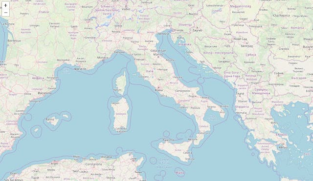
You can customize this default definition of the world map by specifying the centre of your map and the intial zoom level.
# define the world map centered around Italy with a low zoom level
world_map = folium.Map(location=[41.53, 12.28], zoom_start=6)

# display world map
world_map
#if you want to display the physical map
world_map = folium.Map(location=[41.53, 12.28], zoom_start=6, tiles='Stamen Terrain')
#High contrast black and white map
world_map = folium.Map(location=[41.53, 12.28], zoom_start=6, tiles='Stamen Toner')
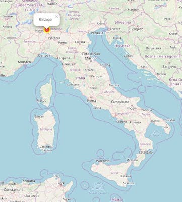
#add a marker with a pop-up label
binzago_map = folium.Map(location=[41.53, 12.28], zoom_start=6)
folium.features.CircleMarker(
[45.62, 9.15],
radius=10, #define how big you want the circle markers to be
color='yellow',
fill=True,
popup=label,
fill_color='red',
fill_opacity=0.6
).add_child(folium.Popup('Binzago')).add_to(binzago_map)
binzago_map